

Kaart van Turkije, 17e eeuw
Map of Turkey, 17th century engraving
Object no.
6061
Op voorraad
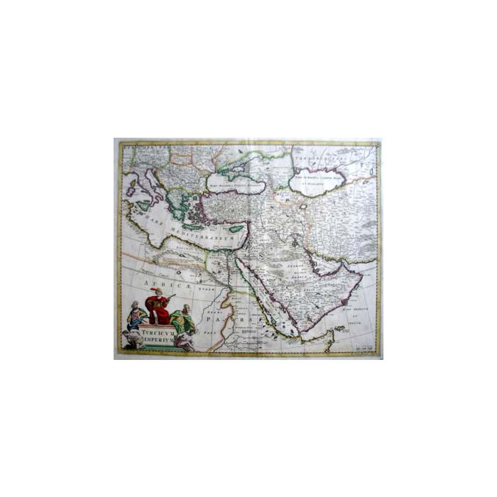
Turcicum Imperium, handgekleurde kaart van het Turkse Rijk met o.a. Arabië, uitgegeven door Frederick de Wit (1630– 1706) en gegraveerd door Joannes lHuilier, Amsterdam, ca. 1665. Afmeting 45 x 56 cm, in lijst. (Verkocht)
Turcicum Imperium. Detailed map issued by Frederick de Wit, c. 1665, covering the Ottoman territories in Balkans, Anatolia, Levant, Arabia and North Africa. The cartouche shows an Ottoman administrator or possibly the Sultan in a victorious pose with his aides on both sides. Below them are war prisoners. De Wit was an important engraver and publisher following the decline of Blaeu business. He acquired and published a number of their plates. (sold)


| Beschikbaarheid | Verkocht |
|---|